Rilkot Fm
Period:
Neoproterozoic
Age Interval:
pre-Ediacaran?
Province:
NW Himalaya Kumaun-Garhwal Tethyan Himalaya
Type Locality and Naming
Type section is in Rilkot camping ground, Gori Ganga Valley in Pithoragarh district, Uttarakhand state. [Original Publication: Sinha, A.K., 1989. Geology of the Higher Central Himalaya. John Wiley and Sons, Chichester, U. K. 1–219.]
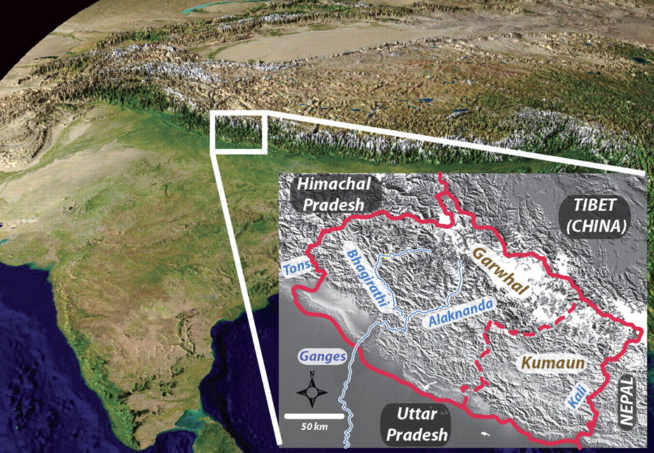
[Figure 1: Location of the Kumaun-Garhwal region (from Celerier et al., GSA Bull 2009)]
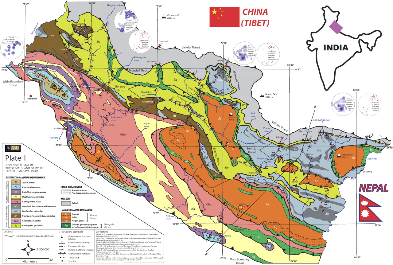
[Figure 2: Geologic map of the Kumaun-Garhwal region (from Celerier et al., GSA Bull 2009)]
Lithology and Thickness
Metamorphics. Presence of porphyroblastic biotite, schist, garnet-rich porphyroblastic schist.
Lithology Pattern:
Gneiss
Relationships and Distribution
Lower contact
Tectonic (Faulted) with the Central Crystallines.
Upper contact
Gradational contact with the overlying the Burphu Fm.
Regional extent
Kumaun to Garhwal regions
GeoJSON
{"type":"Feature","geometry":{"type":"MultiPolygon","coordinates":[[[[78.73,31.7],[78.26,31.55],[77.84,31.52],[77.46,31.22],[77.11,31],[77.45,30.5],[78.13,30.46],[78.45,30.08],[78.96,29.85],[79.47,29.63],[79.85,29.06],[80.21,29.3],[80.41,29.85],[80.77,30.13],[80.59,30.43],[79.71,30.8],[79.11,31.3],[78.71,31.44],[78.73,31.7]]]]}}
Fossils
None
Age
Precambrian. Considering that it is gradational into overlying Ediacaran ?) Burphu Fm, and unknown thickness of metamorphics, then for graphic purposes, indicated as ca. 20 myr interval below Burphu Fm
Age Span:
Beginning stage:
Cryogenian
Fraction up in beginning stage:
0.8
Beginning date (Ma):
652.00
Ending stage:
Cryogenian
Fraction up in the ending stage:
1.0
Ending date (Ma):
635.00
Depositional setting
Not available.
Depositional pattern:
Additional Information
Compiler:
Birendra Singh & O.N. Bhargava.

